Best Boat GPS for Kansas Reservoirs
Anyone who's spent time fishing Kansas reservoirs knows just how quickly a promising morning can turn into a frustrating maze. Whether it's the vast, open water of Milford Lake or the intricate coves of Cheney Reservoir, knowing exactly where you are and how to get back to that hot spot can be a real challenge, especially when the fog rolls in or you're trying to navigate in the dark. This guide is all about helping you cut through that confusion and choose the best boat GPS for navigating these wonderful, yet sometimes tricky, Kansas waters, ensuring safer trips and more successful fishing days.
Why a Boat GPS is Essential for Kansas Reservoir Anglers
Let's be honest, those big Kansas reservoirs aren't just glorified ponds. They're vast, dynamic bodies of water with hidden hazards, subtle contours, and expansive areas that can look remarkably similar once you're out past the familiar landmarks. Relying solely on visual cues or a basic paper map can lead to lost time, lost fish, and even lost peace of mind. A dedicated boat GPS becomes your constant, reliable companion, offering a host of benefits that go far beyond just telling you which way is north.
Navigating Vast, Unfamiliar Waters
Imagine launching your boat onto Milford Lake, Kansas's largest lake, for the first time. It's an immense body of water, and while exciting, it can also be intimidating. Or perhaps you're exploring a new section of Wilson Lake, known for its deep canyons and unique rock formations. Without a GPS, these trips often involve a lot of guesswork, constantly trying to orient yourself, and frequently backtracking. A boat GPS gives you an immediate, precise understanding of your location relative to shorelines, channels, and any hazards. It's like having a local guide right there with you, even if you're hundreds of miles from home. This is especially true when exploring areas off the main channel or trying to find specific points of interest. It prevents you from wasting precious fishing time just trying to figure out where you are, and more importantly, helps you avoid restricted zones or dangerously shallow areas.
Finding and Staying on Productive Fishing Spots
This is where a GPS truly shines for anglers. We all know that feeling when you hit that perfect brush pile, deep weed line, or submerged hump, and the fish just start biting. Without a GPS, relocating that exact spot later, or even the next day, can be nearly impossible. A good boat GPS allows you to mark these "waypoints" with pinpoint accuracy. You can store dozens, even hundreds, of these spots, creating a personal map of your most productive areas. Want to drift fish a specific contour line for catfish? Your GPS can help you stay precisely on that depth break. Chasing a Kansas Walleye Fishing Guide pattern on a specific rock pile? Your GPS will get you there every time. It also helps you repeat successful trolling passes, ensuring your lures are in the strike zone longer. This precision means you spend less time searching and more time with lines in the water, which ultimately leads to more fish in the cooler. It transforms a one-time lucky catch into a repeatable strategy.
Safety and Emergency Preparedness
Beyond just finding fish, a boat GPS is a critical safety tool. Kansas weather can be unpredictable, with sudden thunderstorms, heavy fog, or strong winds whipping up quickly, especially on large, open reservoirs. Losing visibility can turn a fun day on the water into a dangerous situation in minutes. With a GPS, you always know your exact location and can navigate back to the boat ramp or a safe harbor, even when you can't see a thing. In an emergency, knowing your precise coordinates is invaluable for communicating with rescue services, potentially saving critical time. Furthermore, if you fish at night, perhaps targeting Kansas Night Fishing Guide for catfish or crappie, a GPS with reliable navigation lights and detailed charts is non-negotiable for safe passage. It provides a level of confidence that simply cannot be replicated by traditional navigation methods, giving you peace of mind whether you're alone or with family.
Key Features to Look for in a Kansas Reservoir Boat GPS
Not all GPS units are created equal, especially when you consider the specific needs of Kansas anglers. From navigating vast reservoirs to pinpointing subtle structure, certain features stand out as must-haves for anyone serious about their fishing. Thinking about these factors before you buy will save you headaches later.
Detailed Mapping and Chartplotter Capabilities
For Kansas reservoirs, detailed mapping is paramount. You don't just need to know where the shoreline is; you need to see what's under the water. Look for units that offer high-definition contour maps, often called "chartplotter" capabilities. These maps should display depth changes, submerged creek channels, humps, ledges, and even areas of different bottom composition. Many modern units come pre-loaded with regional maps, or you can purchase specific map cards. Brands like Garmin and Humminbird often excel in this area, providing incredible detail down to one-foot contours on many major Kansas lakes like Clinton Lake, El Dorado Lake, and Tuttle Creek Lake. This level of detail is crucial for understanding fish habitats and patterns. Imagine being able to see a detailed map of a submerged roadbed on your screen – that's the kind of advantage we're talking about!
GPS Accuracy and Reliability
What's the point of a GPS if it can't tell you exactly where you are? Look for units with high GPS accuracy. Modern units often incorporate WAAS (Wide Area Augmentation System) technology, which significantly improves precision down to a few feet. An internal GPS antenna is usually sufficient for most recreational boats, but for larger vessels or those with obstructions, an external antenna might provide even better signal reception and reliability. You want a unit that locks onto satellites quickly and maintains that connection, even when fishing under heavy tree cover or in deep canyons. A reliable GPS signal means your waypoints are accurate, and your trail data faithfully records your path, which is essential when trying to get back to that school of Kansas Crappie Fishing Guide you found earlier. When you mark a spot, you want to be able to return to that exact spot, not just a general area.
User Interface and Screen Size
You'll be interacting with your GPS constantly, so a user-friendly interface is crucial. Look for intuitive menus, easily identifiable icons, and responsive controls. Touchscreen models offer a smartphone-like experience, while button-controlled units can be easier to operate with wet hands or gloves. Consider the screen size carefully. While a larger screen might seem like a luxury, it significantly improves readability, especially when displaying detailed maps or split-screen views with other functions like a fish finder. On a bright Kansas summer day, screen brightness and anti-glare properties are also vital. Nobody wants to squint at a washed-out screen when the sun is high. Think about where you'll mount it and how easily you can see it from your usual fishing position.
Integration with Other Electronics
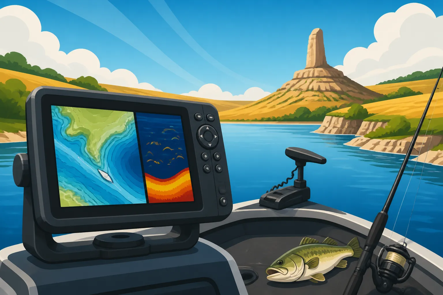
The best boat GPS systems don't just stand alone; they integrate seamlessly with your other marine electronics. Many units can connect to your fish finder, allowing you to view sonar data directly on your chartplotter screen, often in a split-screen format. This means you can see fish arches and structure right alongside your detailed map, identifying exactly where those Kansas Channel Catfish Daily Limit are holding. Some advanced systems can even link to your trolling motor, allowing you to "spot-lock" on a specific waypoint or follow a predetermined path directly from your GPS display. This level of integration creates a powerful, cohesive system that enhances your entire fishing experience. If you're planning to upgrade your entire electronics suite down the line, considering a system that can grow with you is a smart move.
Types of Boat GPS Systems for Kansas Reservoirs
When it comes to outfitting your boat with a GPS, you'll find a few main categories, each with its own advantages and ideal uses. Understanding these differences will help you choose the best fit for your specific fishing style and budget on Kansas waters.
Dedicated Chartplotters
Dedicated chartplotters are the heavy hitters of marine navigation. These units are built solely for navigation, offering the largest, clearest screens and the most advanced mapping capabilities. They often come with robust processors, allowing for quick map redraws and smooth scrolling, even with highly detailed charts. While they might not have built-in sonar, they are typically designed to integrate seamlessly with external sonar modules, turning them into a full-fledged fish-finding and navigation hub. If you're looking for the absolute best in navigation and plan to build a comprehensive electronics suite on a larger boat for chasing trophy walleye or blue catfish across Best Fishing Lakes in Kansas, a dedicated chartplotter is likely your top choice. They provide unparalleled detail and power, especially when combined with premium map cards that reveal every subtle contour of the lakebed.
GPS/Fishfinder Combos
For most recreational anglers in Kansas, a GPS/fishfinder combo unit offers the best of both worlds. These popular devices combine robust GPS navigation with powerful sonar capabilities in a single unit. This means you can view your location on a detailed map while simultaneously seeing fish arches and underwater structure directly below your boat. Many combo units come with different sonar technologies, such as CHIRP, Down Imaging, or Side Imaging, giving you incredibly detailed views of what's beneath and around your boat. This is incredibly useful for finding those elusive schools of Kansas White Bass Guide during their run or pinpointing a brush pile holding crappie. Brands like Lowrance, Garmin, and Humminbird offer a wide range of combo units at various price points, making them accessible to many anglers. You can find excellent options on retailers like Amazon or at your local Bass Pro Shops, making it easy to see the units firsthand and compare features. These units are often compact enough for smaller boats or even kayaks, offering significant functionality without taking up too much dash space.
Handheld GPS Units
Don't overlook the humble handheld GPS unit. While they typically have smaller screens and less detailed mapping than their mounted counterparts, they serve a vital role, especially for smaller boats, kayaks, or as a reliable backup. Imagine your main unit failing or losing power; a handheld GPS can still guide you safely back to shore. They are also incredibly useful for bank anglers who want to mark productive spots along a river or reservoir shoreline, or for those exploring new areas on foot. Their portability means you can take them anywhere, making them versatile tools. While they might not offer the same real-time chartplotter experience, they are excellent for basic navigation, marking waypoints, and tracking your path. Many modern handheld units are rugged and waterproof, designed to withstand the rigors of outdoor use, making them a smart, affordable addition to any angler's gear bag. They might not be the primary navigation tool for a big reservoir trip, but they can be a lifesaver in a pinch.
Smartphone/Tablet Apps
In today's digital age, many anglers consider using their smartphones or tablets with dedicated fishing apps as a GPS solution. Apps like Navionics, C-MAP, or even Google Maps with downloaded offline data can offer surprisingly detailed maps and navigation features. The obvious advantages are cost-effectiveness (you already own the device) and familiarity with the interface. However, there are significant drawbacks to consider for serious Kansas fishing. Smartphones are not designed for the harsh marine environment – they're not fully waterproof (even "water-resistant" devices have limits), their screens can be difficult to see in direct sunlight, and their battery life can drain quickly with constant GPS use. Relying solely on a phone for navigation on a large reservoir is generally not recommended due to these reliability concerns. While great for planning or as a secondary reference, a dedicated boat GPS or combo unit will always provide superior performance, durability, and peace of mind on the water.
| GPS System Type | Best For | Pros | Cons |
|---|---|---|---|
| Dedicated Chartplotter | Larger boats, serious navigation, integrated systems | Large, clear screens; advanced mapping; powerful processing | Higher cost; no built-in sonar (often requires separate module) |
| GPS/Fishfinder Combo | Most Kansas anglers, versatility | Combines navigation & sonar; space-saving; good value | Screen size can be a compromise; not as powerful as dedicated units |
| Handheld GPS Unit | Kayaks, small boats, backup, bank fishing | Portable, durable, affordable; good for basic navigation/waypoints | Small screen; less detailed maps; limited integration |
| Smartphone/Tablet Apps | Planning, secondary reference | Cost-effective; familiar interface; often pre-owned device | Not weatherproof; poor sunlight visibility; battery drain; less reliable |
Setting Up and Maximizing Your Boat GPS on Kansas Waters
So, you've chosen your boat GPS – congratulations! But simply buying it isn't the end of the journey. To truly make the most of this powerful tool on Kansas reservoirs, a bit of careful setup, ongoing maintenance, and smart usage are key. Just like a finely tuned fishing reel, your GPS needs attention to perform at its best.
Installation and Power Considerations
Proper installation is critical for reliable performance. First, consider where you'll mount the unit. It needs to be easily visible from your driving position, accessible for operation, and protected from direct spray where possible. Ensure the mount is sturdy enough to handle vibrations and bumps on choppy water. For power, always connect your GPS directly to your boat's battery through a dedicated fuse panel. Avoid wiring it into existing circuits that might experience voltage drops or interference, which can cause your unit to reset or function erratically. Use marine-grade wiring and connectors to prevent corrosion. If your unit includes an external antenna or a transducer (for combo units), follow the manufacturer's instructions for optimal placement to ensure the best signal reception and sonar readings. A clean, stable power source is the backbone of any reliable marine electronic system.
Loading and Updating Maps
The best GPS in the world is only as good as its maps. Most new units come pre-loaded with base maps, but for the intricate details of Kansas reservoirs, you'll often want more. Many manufacturers offer enhanced map cards (like those from Garmin's LakeVü or Humminbird's Lakemaster series) that provide hyper-detailed contours, navigation aids, and points of interest specific to lakes like Clinton, Milford, or El Dorado. Invest in these if you're serious about finding structure. Equally important is regularly updating your software and map data. Shorelines change, new hazards might emerge, and mapping technology constantly improves. Check your manufacturer's website for updates, often available as downloads to an SD card that you then insert into your unit. Keeping your maps current ensures you have the most accurate information, preventing unpleasant surprises on the water.
Using Waypoints and Trails Effectively
This is where your GPS truly becomes a personal fishing diary. Get into the habit of marking waypoints:
- Productive Spots: Every time you find fish, whether it's a brush pile, a rock hump, or a specific depth contour, mark it. Give it a descriptive name like "Milford Crappie Brush 1" or "Walleye Hump Cheney."
- Hazards: Mark submerged stumps, rock gardens, or shallow areas you want to avoid.
- Navigation Points: Mark channel markers, safe passage routes, or the best route to your favorite Kansas Boat Ramps and Trailer Tips in Kansas.
- Boat Ramps: Always mark the boat ramp where you launch, especially if you're on a new lake. This ensures a stress-free return, even in poor visibility.
Beyond waypoints, utilize the "trail" or "track" feature. This leaves a breadcrumb trail of where you've been, which is invaluable for retracing your path, especially if you're navigating a complex creek arm or trying to replicate a successful trolling pattern. You can often color-code these trails for different trips or purposes, making your digital map a rich resource over time. Learn how to save and manage these trails; many units allow you to save them as routes for future use.
Practicing Navigation and Troubleshooting
Don't wait for a foggy morning or a fishing tournament to figure out your GPS. Spend time on the water practicing with it. Learn how to zoom, pan, mark waypoints, and create routes. Understand how to switch between different map views and how to use any integrated sonar features. Familiarize yourself with all the menu options and settings. Knowing your unit inside and out will build confidence and make it an indispensable tool rather than a frustrating gadget. If you encounter issues, like a loss of GPS signal or unexpected readings, troubleshoot systematically. Check power connections, antenna placement, and consult your unit's manual or online resources. Sometimes a simple software update can resolve minor glitches. Being prepared means you're ready for anything the Kansas waters throw your way. Remember, tools from Bass Pro Shops or on Amazon might come with great online support, so take advantage of those resources if you get stuck.
Disclaimer
This article is for general informational purposes only and does not constitute professional advice. Laws, prices and regulations vary by location and change over time. Consult a qualified professional for guidance on your specific situation.