How Deep Is Wilson Lake?
Anglers often stare out at the vast expanse of a lake like Wilson, wondering what mysteries lie beneath the surface. It's not just about how much water there is; it's about how deep that water goes, because depth dictates where the fish hide, feed, and reproduce. Understanding the varying depths of Wilson Lake is absolutely critical for anyone hoping to land a trophy walleye, a feisty crappie, or a massive striped bass. This guide will dive deep into Wilson Lake's underwater topography, helping you unlock its fishing potential by understanding its depths.
Unveiling Wilson Lake's Depths
Wilson Lake, often heralded as one of the clearest lakes in Kansas, holds quite a few surprises beneath its surface. It's not just a big puddle; it's a complex aquatic environment with significant depth variations that directly impact the fishing. When you’re trying to decipher its mysteries, knowing the general layout of its depths is your first and most crucial step.
The Average and Maximum Depths
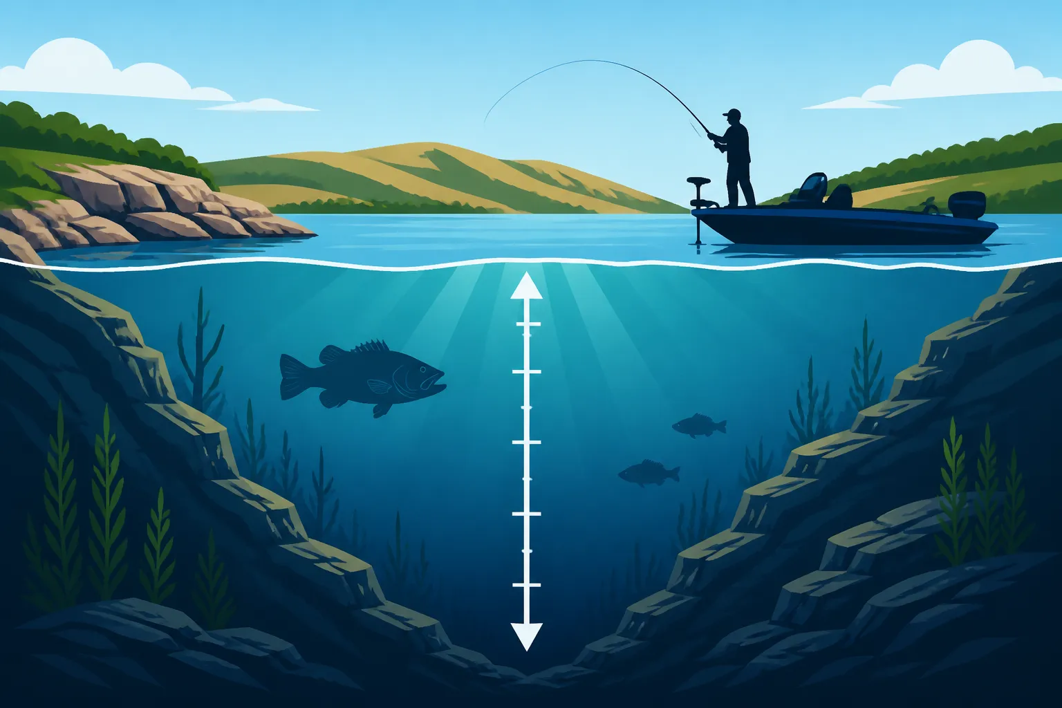
When you’re talking about sheer depth, Wilson Lake can reach impressive lows, plummeting to around 90-100 feet in its deepest channels, particularly near the dam structure. This deep water provides crucial refuge for certain fish species, especially during extreme temperatures in summer and winter. It's where the big blue cats might lurk, or where walleye can escape the bright sun on a clear summer day. These extreme depths are often found along the old river channel, which winds its way through the lake's basin, a remnant of the Saline River that was impounded to create the reservoir.
However, don't let that maximum depth fool you into thinking the entire lake is a bottomless pit. The average depth of Wilson Lake hovers somewhere between 25 and 30 feet. This average accounts for the vast stretches of shallower coves, rocky points, and submerged flats that make up a large portion of the lake. These average depths are where many anglers spend their time, targeting the edges of drop-offs, submerged timber, and other structural elements that hold fish. Knowing this average gives you a good starting point for understanding the general layout of the lake and helps you narrow down where fish might be holding.
Think about how different this is from some of the shallower, muddier reservoirs in Kansas. This clarity and depth are part of what makes Wilson Lake so unique and challenging, yet incredibly rewarding. The varying depths create a multitude of habitats, from sun-baked shallows to the frigid, dark depths, each attracting different types of forage and game fish. It's why one day you might be catching crappie in 15 feet of water, and the next you're searching for walleye in 40 feet. It really forces you to be a versatile angler, constantly adapting your approach to the conditions and the specific depths fish are utilizing.
Understanding Fluctuations in Water Levels
Just like any major reservoir, Wilson Lake's depth isn't static. It's a living, breathing body of water that responds to rainfall, drought, and water management by the U.S. Army Corps of Engineers. Heavy spring rains can significantly raise the lake level, temporarily increasing average depths and submerging new shoreline features that fish will quickly colonize. This can mean brush piles you knew were at 15 feet are now at 20, or newly flooded timber becomes accessible to hungry bass. These rising waters often trigger fish movements, pushing them into newly inundated areas to feed and spawn.
Conversely, prolonged droughts can dramatically lower water levels, exposing structure, creating new drop-offs, and concentrating fish in smaller, deeper areas. This is often a tough time for anglers, as familiar spots become high and dry, forcing a complete rethinking of fishing locations. A spot that was a prime crappie brush pile at 20 feet last year might be bone dry or require fishing in 30 feet of water this year. Before you head out, especially after significant weather events or seasons, it’s always a good idea to check the current lake level reports, often available from the Kansas Department of Wildlife, Parks and Tourism (KDWP) or the Corps of Engineers websites. This simple step can save you hours of futile fishing in areas that are either too shallow or too deep compared to what you remember.
Consider a scenario where the lake is drawn down for maintenance. Suddenly, those once-submerged roadbeds or foundations become visible, offering invaluable insights into the lake's hidden structure that you can then target when the water returns. This dynamic nature means that while the maximum depth remains constant (unless dredging occurs), the fishable depths and the effectiveness of your spots are constantly evolving. Staying informed about these changes is a mark of a truly adaptable angler, ready to adjust their approach based on the most current conditions, and truly understanding the full Kansas Fishing Seasons Guide.
How Depth Shapes Your Fishing Strategy
Understanding the depth of Wilson Lake isn't just a fun fact; it's the cornerstone of a successful fishing strategy. Fish are constantly moving in the water column, and these movements are almost always tied to depth, influenced by temperature, light, and food availability.
Seasonal Fish Movement and Depth
Fish are creatures of comfort, and in Kansas, "comfort" often translates directly to water temperature and available oxygen, both of which are heavily influenced by depth. In the spring, as surface waters warm, many species like crappie and bass move into shallower coves and flats for spawning. You’ll find them in just a few feet of water, making them accessible to bank anglers and those fishing from kayaks. This is when you can really hit the "shallow water bite," often in depths of 5 to 15 feet as fish are actively feeding before or after the spawn.
As summer heat intensifies, fish seek refuge from the scorching sun and warmer surface temperatures. This often means a migration to deeper, cooler water where oxygen levels are more stable. Walleye, for instance, might move to deeper rocky points or channel edges at 20-40 feet, while larger catfish could be found in the deepest holes of the old river channel. Understanding these thermal preferences is key to locating them. If you’re fishing a hot August afternoon, you probably won't find many active walleye in 5 feet of water. For those planning a trip and wanting local expertise, platforms like FishingBooker often list local guides who are experts at finding these deeper, summer fish.
Fall brings a transition, and as water temperatures cool, fish become more active, often moving back towards mid-depths to feed aggressively before winter. They’ll be fattening up, making this a prime time to target active schools in depths ranging from 10 to 30 feet. During winter, especially if you're venturing out for some Kansas Ice Fishing Guide, fish will often suspend at specific depths, sometimes just off the bottom in deeper basins, or closer to cover if the water is shallower and still holds adequate oxygen. The depth you fish under the ice will depend entirely on the species you're targeting and their current feeding patterns.
Species-Specific Depth Preferences
Different fish species have distinct depth preferences, and knowing these can dramatically improve your catch rate on Wilson Lake. Take walleye, for example. While they'll move shallow to spawn in spring, they are predominantly deeper water dwellers, often preferring rocky bottoms or submerged humps in 20-50 feet during much of the year, especially in a clear lake like Wilson. They are sensitive to light, so deeper, dimmer water is their comfort zone, providing them cover to ambush baitfish. If you're looking for tips on these elusive predators, our Kansas Walleye Fishing Techniques article dives deeper into how to effectively target them.
Crappie, both white and black, are often associated with structure. In Wilson Lake, that means submerged timber, brush piles, and the edges of creek channels. While they might be in 5-15 feet in spring and fall, they'll often retreat to 20-30 feet or deeper to suspend over structure in summer and winter. Finding them during the colder months can be particularly challenging, but knowing How Deep to Fish for Crappie in Winter can make all the difference. Their preference for vertical structure means you'll often find them stacked up in the water column, requiring precise depth presentation.
Catfish, particularly blue and flathead, are often found in the deepest parts of the lake, especially along the old river channel or deep holes. Channel catfish are a bit more adaptable and can be found in a wider range of depths, including shallower areas, but the big ones often lurk in the cool, dark abyss, especially during the day. Even the feisty Wilson Lake Striped Bass Fishing opportunities often involve targeting these powerful fish schooling in open water at various depths, frequently chasing baitfish over deep water. They can be found from the surface down to 50 feet or more, depending on where the baitfish are holding.
Targeting Structure and Drop-Offs
Understanding the depth also means understanding the structure. Fish don't just hang out randomly in deep water; they relate to features that provide cover, ambush points, or access to food. Drop-offs, where the depth abruptly changes from, say, 10 feet to 30 feet, are absolute goldmines. These transition zones provide fish with easy access to both shallow feeding grounds and deep sanctuary, making them ideal ambush points. Identifying these subtle (or sometimes dramatic) depth changes is crucial for consistent success.
Submerged humps, old roadbeds, foundations from homesteads long gone, and especially brush piles are all examples of structure that hold fish, and their effectiveness is often tied to the depth at which they sit. A brush pile in 15 feet of water will hold different fish, or the same fish at a different time of year, than one in 35 feet. These underwater features become magnets for baitfish, which in turn attract the larger predators you’re after. The clearer waters of Wilson Lake also mean that fish can relate to structure with greater precision, making it vital for you to pinpoint these key areas.
Many successful fishing trips on Wilson Lake, particularly for species like walleye and crappie, revolve around meticulously working these depth-related structures. It requires patience and a good understanding of how fish use these features at different times of the day and year. A good Wilson Lake Fishing Guide will highlight these key structures and teach you how to effectively fish them based on current conditions and fish behavior, ultimately helping you to truly maximize your time on the water.
Let's put some of Wilson Lake's characteristics into perspective by comparing it to some other popular Kansas lakes:
| Lake Name | Max Depth (Feet) | Average Depth (Feet) | Key Species | Notes |
|---|---|---|---|---|
| Wilson Lake | 100 | 25-30 | Walleye, Stripers, Crappie, Catfish | Known for clear water and rocky structure. |
| Milford Lake | 65 | 20 | Walleye, Catfish, White Bass, Crappie | Largest lake, less clear, extensive river channels. |
| Cheney Reservoir | 45 | 15 | Walleye, Wiper, White Bass, Catfish | Shallow, wind-swept, known for wipers. |
| Tuttle Creek Lake | 50 | 15-20 | Catfish, Crappie, Walleye, White Bass | Often turbid, strong river current influence. |
| El Dorado Lake | 50 | 18-20 | Bass, Stripers, Crappie, Catfish | Diverse habitat, good for recreational boating. |
Practical Ways to Find Depth While Fishing
You can't just guess the depth and expect consistent results on a lake with as varied a bottom as Wilson. Knowing how to accurately gauge the depth is a skill that will dramatically boost your fishing success, whether you're using high-tech gadgets or old-school methods.
Using Sonar and Fish Finders
Let's be real, in today's fishing world, a good fish finder is almost non-negotiable for serious anglers, especially on a lake as dynamic as Wilson. These incredible pieces of technology use sonar waves to map the bottom contour and display the depth right on your screen. You can see sharp drop-offs, submerged humps, and even individual fish or schools of baitfish suspended at certain depths. Brands like Humminbird and Garmin offer excellent units that can help you decipher the underwater world, turning guesswork into precise targeting.
Don't just look for fish blobs on the screen; pay close attention to the bottom contour readings. A sudden change from 15 feet to 40 feet is a major indicator of a prime fishing spot. These depth changes are where fish often congregate, as they provide an easy access route to different feeding grounds and protective cover. Many modern units also allow you to create custom mapping of the lake, highlighting those crucial depth changes you want to target. Learning to interpret what your fish finder is telling you about depth, structure, and fish presence will be one of the biggest leaps you make in your fishing game. Our Best Fish Finder for Kansas Reservoirs guide can help you pick the right one for your needs.
When you’re exploring new water, particularly at Wilson, you might find yourself slowly cruising an area, watching the depth changes on your sonar. This isn't just "driving around"; it's a strategic reconnaissance mission. By mapping out those deep channels, rocky shelves, and submerged timber with your electronics, you build a mental (or even digital) map of prime fishing locations. Guides listed on platforms like FishingBooker rely heavily on this technology to pinpoint exactly where their clients need to drop their lines for the best chance at a catch, making the most of every minute on the water.
Manual Methods and Navigational Charts
Even without fancy electronics, you can still get a good handle on Wilson Lake's depths. Old-school paper maps or digital charts on your phone or tablet often provide contour lines that show depth changes. While not as precise as real-time sonar, they give you an excellent overview of the lake's topography, highlighting channels, humps, and flats. Before heading out, studying one of these charts can give you a significant advantage, helping you pre-plan your attack based on known deep spots and structures, saving you valuable fishing time.
Another tried-and-true manual method is using a weighted line or even your fishing lure to "sound" the bottom. This is especially useful for bank anglers or those in kayaks who might not have sophisticated electronics. Drop your bait or a heavy sinker to the bottom, reel up the slack until your rod tip barely bends, and then count the number of reel handle turns it takes to bring it back to the surface, estimating depth based on how much line your reel retrieves per turn. It's a bit of work, but it gets the job done and connects you more intimately with the water, giving you a tactile sense of the bottom.
For rivers flowing into Wilson Lake, like the Saline River or Smoky Hill River arms, understanding their original river channels is key. These channels typically represent the deepest parts of those arms before the lake was formed. Even if submerged, they dictate the contours of the lake bottom. Knowing the general layout of the original river systems underneath the reservoir can guide you to some of the deepest, fish-holding structures, making your manual depth-finding efforts much more targeted and efficient, even if you’re just reading a map to understand the broader context of a Kansas River Fishing Guide.
Disclaimer
This information is provided for general guidance and informational purposes only. Fishing conditions, lake levels, and regulations can change frequently. Always consult the latest rules and advisories from the Kansas Department of Wildlife, Parks and Tourism before heading out on the water.