How to Read Kansas Reservoir Structure
It's incredibly frustrating to head out to one of Kansas's sprawling reservoirs, full of anticipation, only to spend hours staring at a seemingly barren expanse of water. Many anglers feel like they're just guessing where the fish might be, leading to unproductive days and declining motivation. This comprehensive guide is here to change that, equipping you with the essential knowledge and practical techniques to "read" the underwater landscape of Kansas reservoirs, helping you unlock prime fishing spots and consistently find where the fish are hiding.
Understanding the Basics of Reservoir Structure
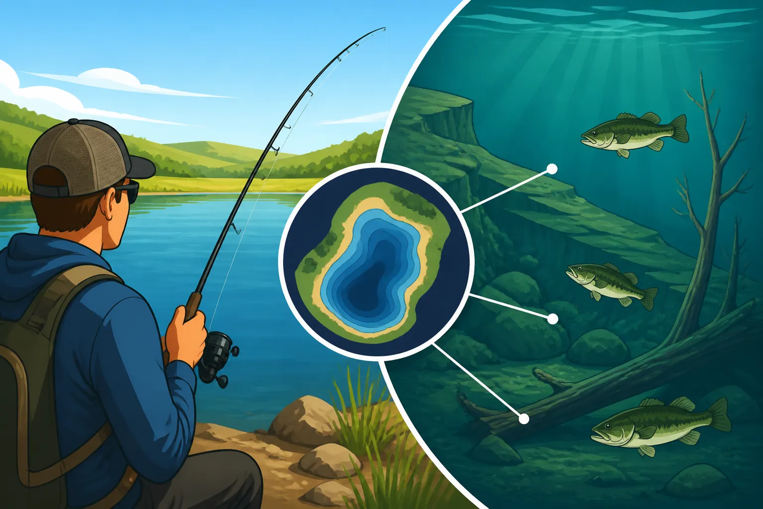
When you look out over a vast Kansas reservoir like Milford Lake or Cheney Reservoir, it’s easy to feel overwhelmed by the sheer amount of water. But beneath that surface lies a complex underwater world, a submerged landscape full of hills, valleys, old riverbeds, and standing timber – what we call "structure." Fish, unlike us, don't just randomly roam. They are creatures of habit and survival, constantly seeking out areas that offer safety, food, and optimal conditions for spawning. Understanding how fish relate to this hidden structure is the single most important factor in becoming a more successful angler, drastically reducing the guesswork and putting you on fish more often. This understanding is key to mastering any Kansas Fishing Seasons Guide or Kansas Fishing Techniques for Beginners.
The Lure of Submerged Points and Humps
Imagine the land that existed before the reservoir was flooded. Any finger of land that extended into a valley, or any isolated hill, now forms a submerged point or hump. These aren't just random formations; they are often underwater highways and feeding stations for fish.
Submerged points, for instance, are essentially underwater extensions of the shoreline. They might drop off gradually or steeply into deeper water, and their contours can vary greatly—some are rocky, others sandy, and some might even have scattered timber or brush. Fish gravitate to points because they act as natural travel corridors, allowing them to move from shallow feeding flats to deeper, safer water. They also create current breaks and ambush points, making them ideal hunting grounds for predators. When the wind blows across a point, it can push baitfish against it, concentrating them and creating a feeding frenzy for game fish. I've had countless days where a single, overlooked point produced fish after fish, simply because it was positioned perfectly to intercept moving schools.
Humps, on the other hand, are isolated underwater hills that don't connect to the shoreline. Think of them as submerged islands. These are absolute hotspots, often overlooked by anglers who stick close to the banks. Humps typically rise from deeper water, providing a sanctuary for fish and a prime feeding ground. The edges of a hump offer sudden depth changes and often accumulate debris or grow submerged vegetation, creating fantastic cover. They act as magnets for baitfish, which in turn attract larger predatory species like walleye or bass. Locating a good hump, especially one with rocky features or scattered brush, can be like finding a hidden treasure chest in the middle of a lake.
The Importance of Old River and Creek Channels
Before the dams were built and the valleys filled with water, these reservoirs were once river and creek systems. The beds of these ancient waterways remain beneath the surface, forming old river and creek channels. These channels are arguably the most significant structural elements in any large Kansas reservoir.
Think of these channels as underwater interstates for fish. They provide the deepest water in the reservoir and offer distinct edges, ledges, and breaks that fish use for migration, feeding, and protection, especially during extreme weather conditions or changes in water temperature. For species like Kansas Blue Catfish Facts and Limits or Kansas Walleye Fishing Techniques, the main river channel is a primary thoroughfare, offering consistent access to deep water and current. Baitfish schools often suspend over or along the edges of these channels, providing a constant food source for predators. Learning to identify these old channels and their associated features—like bends, confluences (where two channels meet), and adjacent flats—is critical.
The steep drop-offs along the channel edges create perfect ambush points. In the summer, fish will often hold tightly to these deeper channel edges to find cooler water and higher oxygen levels. In the spring and fall, they use the channels to move between spawning grounds and deeper wintering holes. Drifting or trolling along these channel edges is a highly effective strategy, allowing you to cover ground and present your bait or lure directly in the fish's travel path. Over time, you'll learn that understanding these submerged arteries is the backbone of successful reservoir fishing.
Tools and Techniques for Reading Structure
Successfully reading reservoir structure isn't just about knowing what's there; it's about having the right tools and knowing how to use them. While visual cues can sometimes offer hints, the real game-changers are electronics and detailed mapping. These modern aids transform the invisible underwater world into a legible map, giving you a distinct advantage over anglers who rely solely on guesswork.
Decoding Your Fish Finder Screen
Your fish finder is perhaps the most valuable tool for understanding what lies beneath your boat. It’s essentially your underwater eyes, translating sound waves into a visual representation on a screen. However, simply having a fish finder isn't enough; you need to understand what its various readings mean.
At its most basic, your fish finder emits a sound wave that travels through the water, bounces off objects (fish, bottom, structure), and returns to the transducer. The time it takes for the wave to return, and its strength, determines what you see on your screen. Stronger, denser objects like the bottom or large fish will produce thicker, brighter returns. Fish often appear as arches, especially if they are moving through the sonar cone. Learning to differentiate between a tiny baitfish school (often a fuzzy cloud) and a larger game fish is an acquired skill, but one that pays dividends. Adjusting settings like sensitivity can help you pick up fainter returns or cut through noise, allowing you to see brush piles or suspended fish more clearly. Many modern units, like those you can find on Amazon, offer incredibly detailed displays, but the fundamentals remain the same.
Beyond traditional 2D sonar, technologies like Down Imaging and Side Imaging have revolutionized how we see structure. Down Imaging gives you a photographic-like view directly beneath your boat, making it incredibly easy to identify submerged trees, rock piles, or even individual logs. It takes the guesswork out of what that "blob" on your 2D sonar really is. Side Imaging, on the other hand, allows you to scan wide areas to either side of your boat, revealing structure that might be hundreds of feet away. Imagine cruising along and seeing a detailed image of a submerged roadbed, a brush pile, or a rock-strewn ledge far off to the side – all without driving directly over it. This capability is phenomenal for covering water and identifying potential hot spots, especially for species that relate to distinct edges and cover. To effectively use these tools, you might also want to look into a quality Kansas Fish Finder Buying Guide to ensure you're getting the right unit for your needs.
The Power of Contour Maps and GPS
While fish finders show you what's directly beneath or around your boat, detailed contour maps give you the big picture. These maps show you the topography of the lakebed before you even launch your boat, illustrating depth changes, submerged points, humps, old creek channels, and even artificial structures that have been added.
Think of contour lines on a map like elevation lines on a topographic map of land. Closely spaced contour lines indicate a steep drop-off, while widely spaced lines suggest a gradual slope or a flat. By studying these maps at home, you can pinpoint prime areas to investigate once you're on the water. You can identify key pinch points, prominent humps, or the deep bends of an old river channel where fish are likely to congregate. This pre-fishing planning saves invaluable time on the water, allowing you to navigate directly to high-potential areas rather than blindly searching. Many marine electronics companies offer highly detailed map chips that you can plug directly into your fish finder, making navigation incredibly precise.
GPS (Global Positioning System) works hand-in-hand with contour maps. Your GPS unit shows your boat's exact position on the map, allowing you to navigate precisely to those promising spots you identified. Even better, you can mark waypoints on your GPS for every brush pile, rock pile, productive point, or channel bend you find. This creates a personal fishing database, making it easy to return to productive spots year after year, or even hour after hour. When you combine a detailed map, your GPS, and your fish finder, you're essentially given a cheat sheet for the entire lake, revealing the hidden structure that holds fish. For those considering upgrades, a good Kansas Trolling Motor Guide can help you stay on these precise spots once you find them. Having the right Kansas Boating Safety Equipment Requirements is also important when out on the water.
Applying Structure Knowledge to Common Kansas Species
Knowing about structure is one thing, but understanding how specific Kansas game fish interact with that structure is where the magic really happens. Different species have different preferences, and these preferences often change with the seasons and even the time of day. Tailoring your approach to match the fish's structural leanings is key to consistent success.
Walleye and Crappie: Structure Sweet Spots
Both walleye and crappie are highly sought-after species in Kansas, and both relate strongly to structure, though often to different types and at different depths.
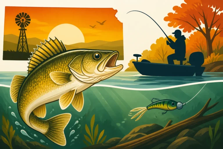
Walleye, with their light-sensitive eyes, often prefer deeper, rockier structures and will avoid direct sunlight. They are classic ambush predators, and they love to position themselves along the edges of submerged points, humps, or the breaks of old river and creek channels. These areas provide current breaks and a perfect vantage point to dart out and ambush baitfish. In the spring, walleye might move shallower to rocky points or flats for spawning, but as water temperatures rise, they'll retreat to deeper humps, main lake points, or the cooler confines of the old river channel edges. Look for them on the downcurrent side of a point or where a channel swings close to a prominent piece of structure. Areas with a clean, hard bottom, often comprised of rock or gravel, are frequently walleye magnets. When targeting them, remember the Kansas Walleye Minimum Length Limit of 21 Inches and focus on presenting your lure or bait near these defined structures, perhaps by trolling crankbaits or jigging spoons.
Crappie, on the other hand, are absolute lovers of vertical cover and brush. While they will utilize deeper structure, they are often found in association with submerged timber, brush piles, cedar trees, and man-made fish attractors. In the spring, crappie flood into shallow bays and creek arms, seeking out flooded brush, docks, or standing timber to spawn. As summer progresses, they move to deeper brush piles, submerged timber lines, and the vertical edges of creek channels in 15-25 feet of water. These structures offer them protection from predators and provide prime ambush points for passing baitfish. In winter, they'll often suspend in large schools around the deepest brush piles or vertical timber that rises from the old creek channels. When fishing for crappie, focus your efforts on probing these specific covers, perhaps by vertical jigging or slow-trolling minnows. Keep an eye on the Kansas Crappie Length and Bag Limits when you're having a particularly good day!
Catfish and Bass: Diverse Structural Preferences
While walleye and crappie have distinct structural preferences, catfish and bass showcase an even wider range, adapting to various types of cover and depth depending on the species and season.
Catfish, particularly the larger blue and flathead species, are strongly tied to the deepest parts of the reservoir: the old river and creek channels. These channels provide current, which catfish absolutely love, and also offer deep holes and scour marks where they can hide and ambush prey. For Kansas Catfish Daily Limits, the primary channel in a large reservoir like Tuttle Creek Lake or the Kansas River can be a goldmine. Blue catfish will often suspend near current breaks or along the bends of the channel, feeding on baitfish. Flathead catfish are ambush predators that prefer heavy cover like large log jams, root wads, or rock piles within or along the edges of these deep channels. Channel catfish are more versatile and can be found in a wider range of habitats, from riprap banks and standing timber to the flats adjacent to channels, but they too utilize current and cover. Targeting catfish often involves anchoring near a prominent channel bend or a large piece of timber, or drifting baits along the channel edges.
Bass, encompassing both largemouth and smallmouth, also have strong structural ties but diverge significantly in their preferences. Largemouth bass are the kings of cover. They thrive in areas with abundant vegetation, submerged timber, brush piles, stumps, and artificial structures like docks or bridge pilings. They use this dense cover for ambush points and protection. In reservoirs, you'll often find largemouth in creek arms, flooded timber stands, or along points that have a good mix of rock and brush. They'll relate to both shallow cover for feeding and deeper cover for security, often moving between the two.
Smallmouth bass, on the other hand, typically prefer rocky, open-water structures. They are drawn to rocky points, gravel humps, submerged rock ledges, and riprap banks. They prefer cleaner water and are often found in the main body of the reservoir, particularly in larger, clearer lakes like Wilson Lake. While they'll use cover, it's usually rocky habitat rather than dense vegetation. Fishing for smallmouth often involves casting crankbaits or jigs to these rocky structural elements, focusing on depth changes and current breaks. Whether you're targeting largemouth or smallmouth, understanding their preferred structural habitat is paramount.
Here's a quick reference table for common Kansas game fish and their preferred structures:
| Fish Species | Preferred Reservoir Structure (General) | Key Seasonal Locations |
|---|---|---|
| Walleye | Rocky points, humps, old river/creek channel edges, sharp breaks, main lake points, riprap. | Spring: Rocky points, shallow flats adjacent to channels for spawning. Summer: Deep humps, main lake points, channel edges, thermocline. Fall: Steep breaks, channel swings, rocky flats. Winter: Deep channel holes, sharp drops. |
| Crappie | Submerged timber, brush piles, standing trees, docks, bridge pilings, creek channels, vertical cover. | Spring: Shallow brush, flooded timber, docks for spawning. Summer: Deep brush piles, timber lines along channels, suspended over channels. Fall: Deeper brush, channel edges, baitfish schools. Winter: Deepest brush piles, suspended in main channels, vertical timber. |
| Channel Catfish | River channels, deep holes, timber, riprap, flats near channels, current breaks. | Spring: Shallow flats, creek mouths, riprap. Summer: River channels, timber, deep holes, current breaks. Fall: Deep channels, current seams, timber. Winter: Deep channel holes, suspended in warmer areas. |
| Blue Catfish | Main river channels, deep holes, current breaks, large log jams. | Spring: Channel edges, shallow flats adjacent to channels. Summer: Deepest channel holes, strong current breaks, timber. Fall: Deep channels, baitfish concentrations. Winter: Deep channel holes, power plant discharges (if applicable). |
| Flathead Catfish | Large log jams, root wads, heavy timber, rocky holes in deep channels. | Spring: Shallow timber, creek mouths. Summer: Heavy cover in deep channels, large log jams. Fall: Deep timber, channel bends. Winter: Deepest heavy cover, dormant. |
| Largemouth Bass | Submerged timber, brush piles, dense vegetation, docks, stumps, creek arms. | Spring: Shallow spawning flats, submerged vegetation, brush in coves. Summer: Deeper brush, timber, thermocline, shaded docks, vegetation edges. Fall: Ambush points near baitfish, points with cover. Winter: Deep timber, brush, main lake points. |
| Smallmouth Bass | Rocky points, humps, ledges, riprap, gravel flats, main lake structure. | Spring: Rocky spawning flats, main lake points, ledges. Summer: Deep rocky humps, main lake points, clear water rock piles. Fall: Rocky points, breaks, baitfish schools. Winter: Deep rocky structure, humps. |
Armed with the knowledge of how fish relate to specific structures and the tools to find them, you're well on your way to cracking the code of Kansas reservoirs. It takes practice, but the rewards of understanding the underwater world are truly endless. Whether you're a seasoned angler or just starting out, mastering reservoir structure will undoubtedly lead to more successful and enjoyable days on the water.
Disclaimer
This article is for general informational purposes only and does not constitute professional advice. Laws, prices and regulations vary by location and change over time. Consult a qualified professional for guidance on your specific situation.